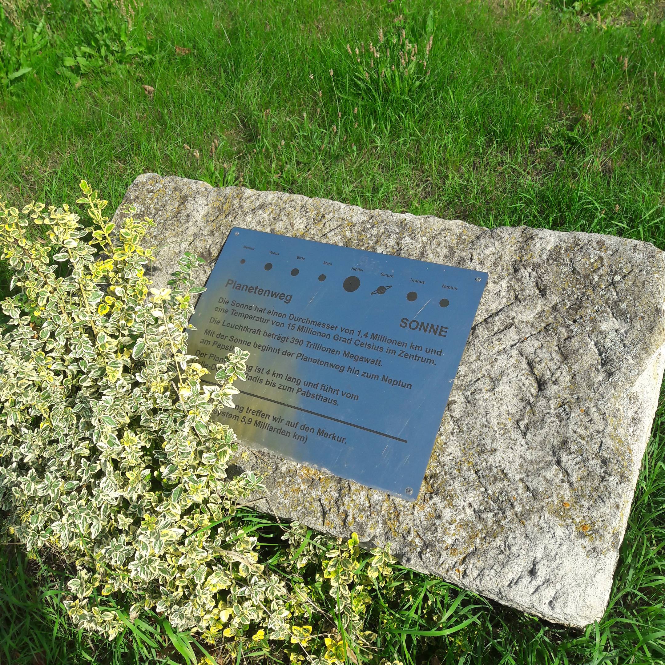
Planet Path
Germany currently boasts about 100 "planet paths". Three of them are in Saxony-Anhalt: The Planetenweg in Radis near Kemberg opened on September 24, 2016, in honor of Johann Gottfried Galle. The distance between individual stops, representative of the planets, uses a ratio of 1:1 billion, meaning that "a large step for a man" (about 1 meter) corresponds to a million kilometers (= 1 billion meters) in actual space. This would mean circling the earth at the equator almost 25 times. The path is about 4.5 km long.

Heimatverein Radis e.V.
Radiser Bahnhofstraße 16
06901 Kemberg
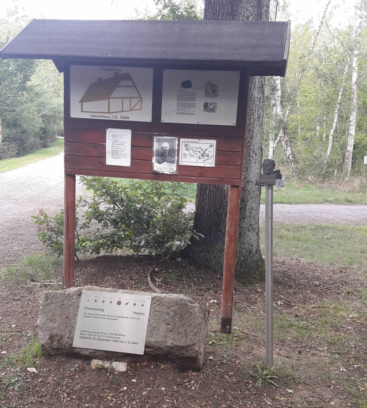
Information board and Neptune stone at the Pabsthaus
The path begins in the center of Radis, near the Johann Gottfried Galle monument and the "sun stone", representing the sun, and ends at a stone representing the planet Neptune near the Pabsthaus, where Johann Gottfried Galle was born. Thus, the Radis Planetenpfad joins two sites connected to one of the most famous Radis citizens.
Part of the Planet Path lies along the R1 cycle route and the Coal | Steam | Light | Lakes-route, making a brief detour to the Pabsthaus (en route to Ferropolis or to Lutherstadt Wittenberg) a definite recommendation. The Pabsthouse marks the spot where the birth house of Johann Gottfried Galle once stood (it burned down around 1910). There is also reason to believe that Luther stopped at the Pabsthaus tavern on his travels. Today, the property is privately owned, but there is a commemorative plaque.
There are many geocache points along the Planet Path. With special devices or a geocaching app on your smartphone, you can enjoy a GPS scavenger hunt here.
- 1812 - 09.06. Johann Gottfried Galle im Pabsthaus bei Radis geboren. Er besuchte die Schule in Radis und legte später Abitur mit Auszeichnung in Wittenberg ab.
- 1833 - Er schloss in Berlin das Studium der Mathematik und Philosophie erfolgreich ab und begann 1836 mit den meteorologischen Beobachtungen.
- 1846 - 23.09. J. G. Galle entdeckte den Planeten neptun aufgrund der Berechnungen des französischen Mathematikers Le Verrier
- 1884 - J. G. Galles schaffenreiches Arbeitsleben als weltbekannter Astronom und Mathematiker in der Position des Rektors an der Universität Breslau wird in der Feier anlässlich seines Goldenen Amtsjubiläums geehrt. Er wird zum Geheimen Regierungsrat ernannt.
- 1910 - 10.07. verstorben in Potsdam
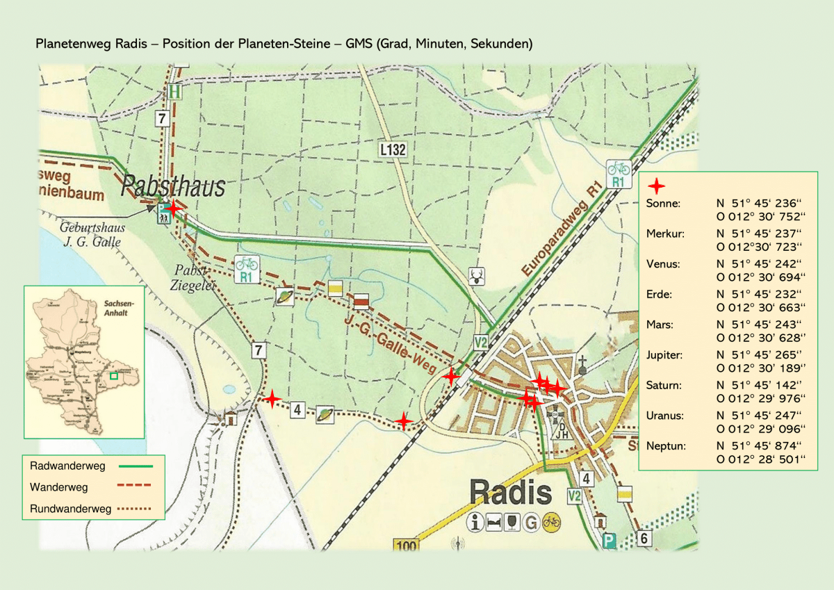
Karte zum Platenweg mit GPS-Koordinaten